The Rung community is an ethnic group that shares a common culture, traditions, religion, language, and history. They reside in three valleys located in the northwestern part of Nepal and India: Byans, Darma, and Chaudas. These valleys consist of multiple villages, each with a population ranging from twenty to a hundred families.
I am Rung, I have been documenting our landscapes, culture and traditions. Presenting you images of three villages in Byans valley, I have yet to photograph four more village in the Byans valley.
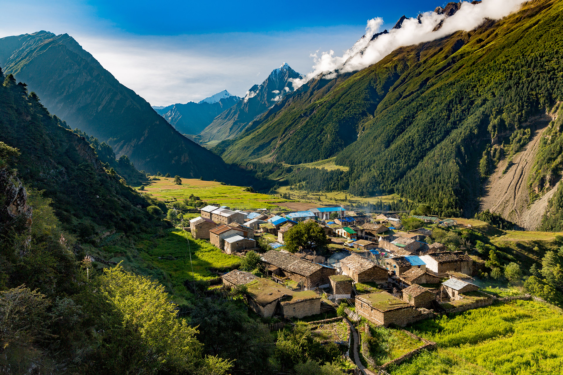
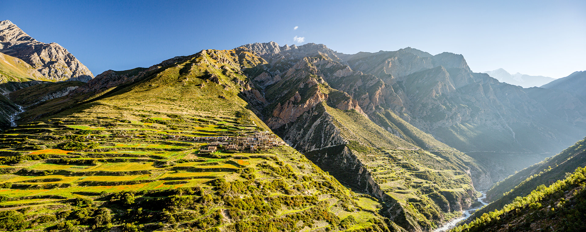
Chhangru Village, is the second last village in the northwestern part of Nepal. On the other side of the mountain is Tibet.
Chhangru Village
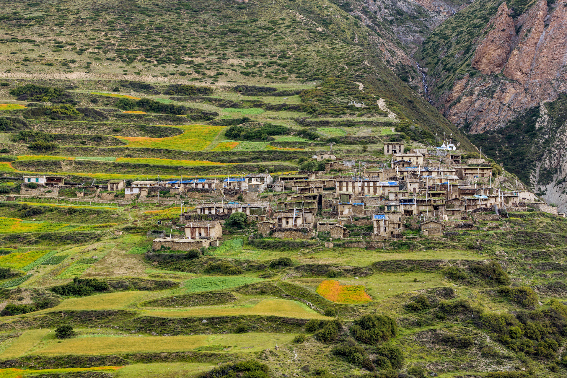
Garbyang Village, popularly known as sinking Rung village of Uttrakhand, India, due to the constant white soil erosion beneath it. It is said, Garbyang was well known for Indo-Tibet business center of India, and was also known as ‘Chhota Vilayat’ prior to Indo-China war in 1962. It is said, though the trade route was reopened in 80s, the glory that the place had before the war was long lost.
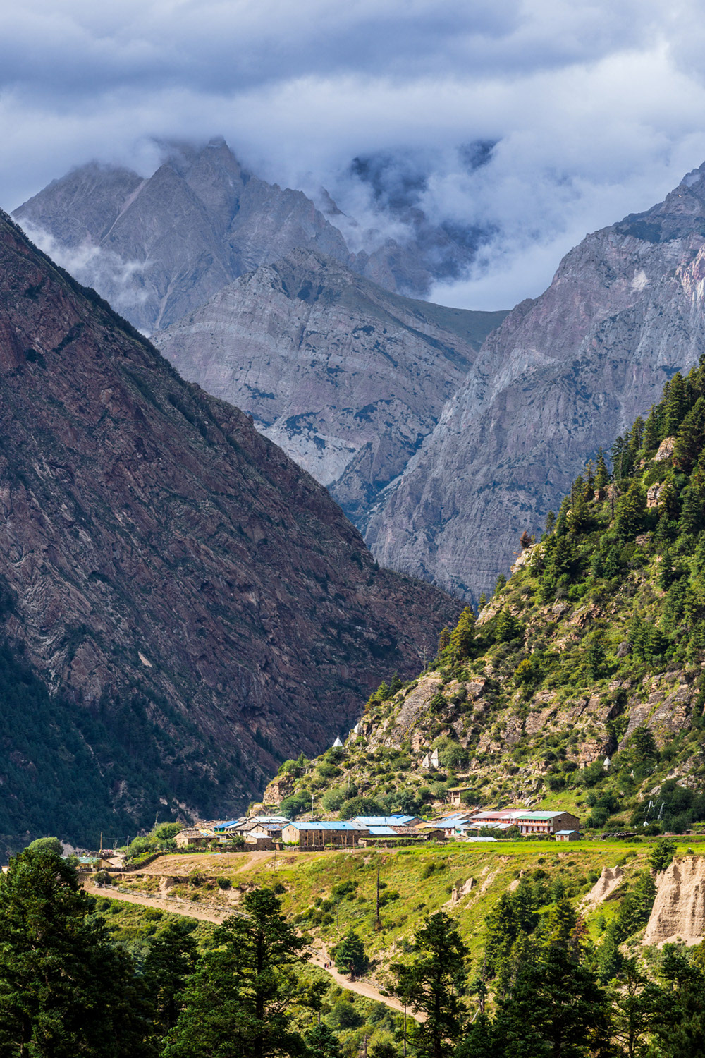
Tinkar, another beautiful village in Rung land. It is the last Rung village in northwestern part of Nepal. Tibet is on the other side of the mountain.
Tinkar Village
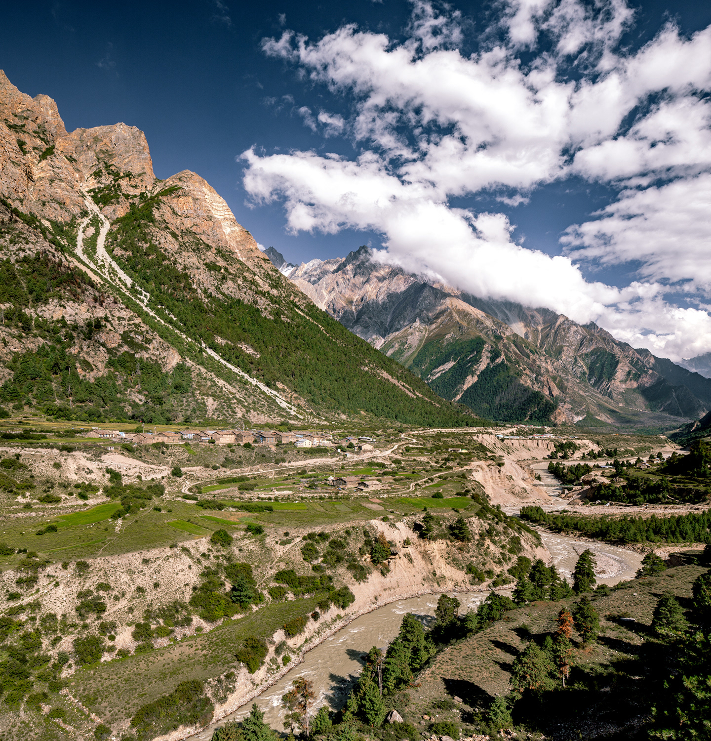
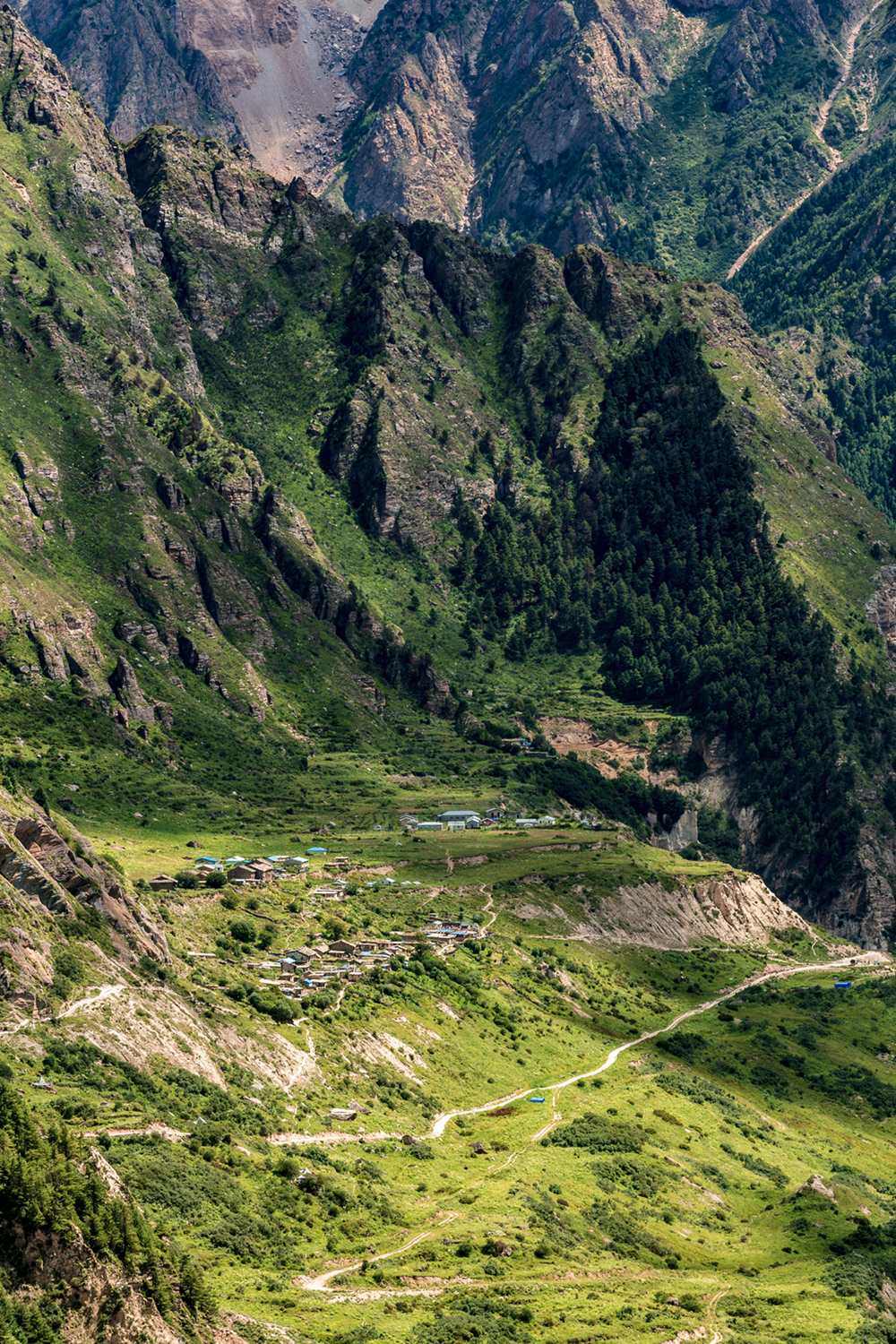
Gunji Village on left, flowing in the middle now known as Kuti river.